
Features FHP GIS App
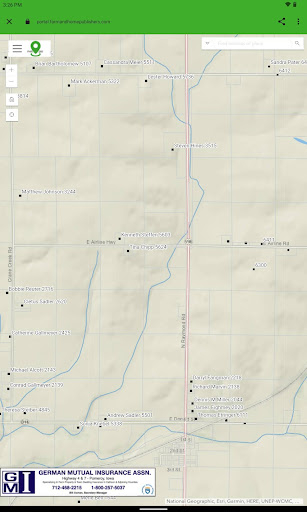
The FHP GIS App provides a nationwide map-based view of parcel boundary and ownerinformation across over 3,200 counties (99% of the US).
In addition, the App also providesaccess to residential addresses and contact information in over 500 counties, primarily acrossthe Midwest.
Local, regional, and national businesses are shown on the map and are invited tobe represented in the App alongside other organizations.Several unique data sets are included in the FHP GIS App.
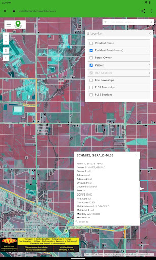
These include:- Nationwide parcel ownership data, including addresses, property values, ownerinformation, and much more.- Regional geocoded residential data, including contact information- Businesses and organizations, as geocoded locations and scrolling banners- Public Land Survey System (PLSS) Townships and Sections, nationwide- Nationwide US Census Subdivisions (Civil Townships and Census County Division (CCDs))- Nationwide counties and states- Worldwide satellite imagery- Worldwide street and administrative areas- Nationwide National Agriculture Imagery Program (NAIP) imagery in real-color- Nationwide National Agriculture Imagery Program (NAIP) imagery in infrared-color- Real-time traffic feeds- Real-time weather feeds- Real-time natural disaster feeds- More.Additionally, several unique tools and functions are included in the FHP GIS App.
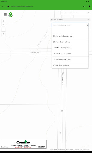
These include:- A custom search tool, by parcel owner, resident name, business owner, as well assearching by location, place name, or address- A secure login experience manages the user’s map experience.- Filtering the user experience, specifically on Parcels and Resident data, to selectcounties based on accessible counties to that particular user- Map interactions are customized to retrieve information from select layers throughinteractive click events- Layers are interactively turned on and off in the map view- A map key/legend is dynamically generated based on the visible map layers- Measuring tools to help determine area, length, and XY location, in several differentunit-of-measurement options- Drawing tools to allow temporary markups and notes- Additional layers accessible from external web feeds- Bookmarks to establish stored locations and zoom extents for the user’s map view- Screenshot and print-to-file for storing information for laterFor the customer already familiar with Farm and Home Publisher’s Plat Books, the FHP GIS Appextends the printed books and provides a digital, interactive view of the same map contents.
Inaddition, it adds more layers and will be ever-expanding to incorporate the needs and wishes ofthe FHP community.
Weather Features
Get accurate weather forecasts and real-time updates.
Food & Dining
Discover recipes and order food from your favorite restaurants.
Shopping Features
Shop online and find the best deals.
See the FHP GIS App in Action
Get the App Today
Available for Android 8.0 and above